December 21, 2017 | 18:48 (GMT+7)
Symposium recalls 1968 Tet General Offensive and Uprising in Can Tho
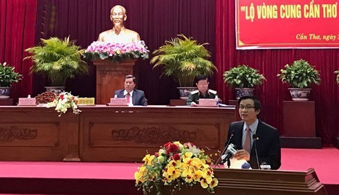
Cultural researchers and veterans again assessed the significance of the 1968 Tet General Offensive and Uprising at a symposium held in the Mekong Delta city of Can Tho on December 20.
    |
 |
At the symposium. Photo: vov.vn
|
Pham Van Hieu, Deputy Secretary of
the Can Tho city Party Committee, said that Lo Vong Cung (arc-shaped road)
which stretches 30km from Cai Rang town to Ba Se-Giao Dan in O Mon district was
the fiercest battlefield in former Can Tho province during the 1968 Tet General Offensive and Uprising .
Despite disadvantages in numbers and
weapon, Can Tho people and armed forces liberated four key communes with 10,000 people,
he said.
Hien noted that Lo Vong Cung has
been recognized as a national heritage site and all wards and communes along the
road have been honored with the title of “Hero of the People’s Armed Forces.”
Many delegates at the symposium
proposed tapping tourism potential of relic sites along Lo Vong Cung to turn
the road into a “green tourism belt.”
During the anti-US resistance war,
Lo Vong Cung served as the enemy’s defensive area to protect the headquarters
of the IV Corps Tactical Zone, Tra Noc Airport
and representative offices of the US and its puppet government in Can
Tho.
Within the framework of the
symposium, there is an exhibition displaying 231 objects and 37 photos on the
uprising of soldiers and people of Can Tho in the Spring of 1968.
Source: VNA