According to the National Center for Hydro-Meteorological Forecasting, at 10a.m. on August 24, the eye of Kajiki was located at 17.4 degrees North latitude and 110.9 degrees East longitude, about 580 km east-southeast of the north-central province of Nghe An and 560 km from neighboring Ha Tinh province.
The storm was packing sustained winds of 118-149 km per hour (levels 12–13 on the Vietnamese scale), with gusts up to 167 km/h (level 15), and moving westward at around 20 km/h.
    |
 |
|
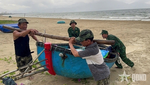
Measures applied to protect locals' property |
By 10p.m. the same day, Kajiki is forecast to be in the Southern part of Gulf of Tonkin, with winds of level 13–14, gusting up to level 16. Its center is about 300 km east-southeast of Nghe An and 270 km from Ha Tinh. The storm is expected to continue moving west-northwestward, threatening coastal provinces from Thanh Hoa to Quang Tri.
At 10a.m. on August 25, Kajiki is forecast to be just offshore between Thanh Hoa and Quang Tri, sustaining winds of level 12–13, gusting to level 15. The storm will weaken as it moves inland, reaching the Laos – Thailand border on August 26 with winds down to level 6, gusting level 8, before weakening into a tropical depression.
Dangerous conditions at sea, on land
Forecasters warn of extremely rough seas across the northern part of the East Sea (including the Hoang Sa special zone), the Gulf of Tonkin, and coastal waters from Thanh Hoa to Hue. Storm surges of 0.5–1.5 meters are predicted, with sea levels in some places such as Hon Dau (Hai Phong) and Sam Son (Thanh Hoa) expected to reach over 3.5 meters. Low-lying coastal areas and estuaries face a high risk of inundation, especially during the evening of August 25.
On land, strong winds of level 8–10, and up to level 13 near the storm’s center, are forecast from Thanh Hoa to Quang Tri starting late on August 24. Northern provinces from Quang Ninh to Ninh Binh will also experience gale-force winds up to level 8. Torrential rainfall is expected from the Red River Delta through central Vietnam, with widespread totals of 100–150 mm, locally exceeding 250 mm. In Thanh Hoa to northern Quang Tri, rainfall could reach 200–400 mm, with some areas possibly over 700 mm, raising risks of flash floods and landslides.
Evacuation and port closure plans
To minimize risks, authorities in Thanh Hoa, Quang Tri, Hue and Da Nang have drawn up evacuation plans for 152,387 households, totaling nearly 587,000 people. Seven coastal provinces from Ninh Binh to Quang Ngai have ordered a ban on fishing vessels going to sea. By the morning of August 24, border guard forces had informed and guided nearly 60,000 fishing boats with almost 249,000 crew members to avoid dangerous areas. Over 49,000 vessels have already sought shelter at ports.
Agricultural areas are also at risk. The north-central region has nearly 300,000 hectares of rice at various stages of growth, over 77,000 hectares of fruit crops, and 57,000 hectares of rubber plantations, all potentially exposed to storm damage. More than 5,700 fish cages and 384 aquaculture watch huts are in vulnerable zones.
Reservoirs across the north-central provinces are currently at 71–82% capacity, with dozens under repair or reinforcement. Authorities are lowering water levels in major lakes to reduce downstream flood risks.
The Government has issued multiple urgent directives, with Prime Minister Pham Minh Chinh's dispatch calling for emergency preparedness. Ministries, provincial authorities and military units have been ordered to implement evacuation, secure dykes and dams, and ensure communication lines remain open. The Ministry of Foreign Affairs has sent diplomatic notes to the embassies of China and the Philippines in Vietnam, requesting assistance for Vietnamese fishermen and vessels seeking safe shelter from the storm.
The Vietnam People’s Army has been placed on high alert. The General Staff has directed Military Zones 3, 4 and 5 to work closely with local authorities, identify high-risk areas and assist in reinforcing homes, schools and public infrastructure. Troops have been deployed to support evacuations in areas prone to landslides and flash floods.
The Border Guard has stepped up efforts to account for all fishing vessels, while the Navy, Coast Guard and Air Force have been placed on standby for rescue operations. The military has mobilized more than 346,000 personnel and 8,200 vehicles of various kinds, including aircraft, ships, and armored vehicles. The Viettel telecom group has prepared mobile teams and drones (flycams) to survey vulnerable areas, detect cracks or landslide threats, and ensure communications in case of network disruptions.
Localities are also working with media to keep residents updated. State broadcasters and newspapers are running frequent storm bulletins, while 18 million storm-preparedness messages have been sent via Zalo to residents in coastal provinces.
Mai Van Khiem, Director of the National Centre for Hydro-Meteorological Forecasting, said that weather conditions at sea and onshore in the storm’s path will be “extremely dangerous and unsafe for all activities, including tourism, fishing, transport and aquaculture.”
He warned of widespread risks to boats, fish cages, dykes, coastal roads, and low-lying settlements.
Authorities urge residents in storm-prone provinces to strictly follow evacuation orders, secure homes and belongings, and avoid travelling during the storm.
Source: VNA