Storm Comay, the fourth in the East Sea this year, was at around 16.7 degrees North and 118.3 degrees East, in the east of the East Sea's northern waters as of 4am on July 24.
    |
 |
|
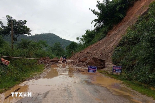
Heavy rain causes a landslide. (Photo for illustration) |
It is expected to shift east-southeast by 4pm on July 24, travelling at 10-15km per hour with wind speeds at Level 9–10, gusting up to Level 12.
By 4am on July 25, it is forecast to turn northeast, picking up speed to 20–25 km per hour, and make landfall on the northern coast of Luzon, the Philippines, with wind speeds at Level 8 and gust up to Level 10.
By 4am on July 26, the storm is projected to continue moving northeast at 25–30 km per hour and gradually weaken into a tropical depression.
Northern Vietnam and the north-central provinces of Thanh Hoa and Nghe An are bracing for moderate to heavy rainfall and thunderstorms from July 24 through July 25 night, with rainfall accumulation of 60–130mm and some areas potentially exceeding 250mm. Heavy rain of more than 100mm within three hours is also forecast.
In highlands areas in the central and southeastern regions, scattered showers and thunderstorms are forecast for July 24 afternoon and evening, bringing 15-30mm of rain, with some areas seeing over 80mm. Thunderstorms may trigger tornadoes, lightning, hail, and strong gusty winds.
The deluge poses risks of flooding, especially in low-lying, urban and industrial areas, alongside flash floods in small rivers and streams, and landslides on steep terrain.
Authorities have warned of heightened risks of flash floods and landslides in many communes and wards across Son La, Lao Cai, Phu Tho, Thanh Hoa, and Nghe An provinces.
Source: VNA