The Bureau of Meteorology's Volcanic Ash Advisory Center (VACC), in Australia's Northern city of Darwin, issued maps showing an ash cloud heading in three directions from Sinabung, to the North, Northwest and South-Southeast.
    |
 |
|
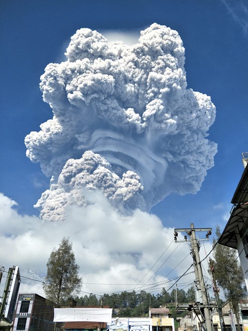
Mount Sinabung volcano sends a towering plume of ash more than 7km into the air, its biggest eruption this year. (Photo: BNPB) |
Indonesian authorities also upgraded its Volcano Observatory Notice for Aviation (VONA) to red, its highest warning, and said the ash-cloud top had reached 7,276 metres.
Sinabung is about 75 km southwest of Kualanamu International Airport in Medan.
Nur Isnin Istianto, head of the regional airport authority, said Kutacane airport in Aceh province had been closed, but the wind direction allowed Kualanamu, Meulaboh and Silangit airports to remain open.
Sutopo Purwo Nugroho, a spokesman for Indonesia's Disaster Agency, said the eruption began on February 19 morning, accompanied by multiple earthquakes and showering surrounding villages with small rocks.
In five districts it became dark with a visibility of about 5 meters, he said.
No casualties were reported, but the agency urged the public to stay out of a 7-km exclusion zone around the crater, and watch for further warnings, which could cover floods.
Areas around the crater of the volcano, located about 1,900 km northwest of the capital of Jakarta have been off-limits for several years because of frequent volcanic activity.
Source: VNA