Downpours were widespread, with rainfall exceeding 100 mm in many places between 7p.m. on August 26 and 3a.m. on August 27, including Cam Phuc of Hai Phong (166.6 mm), Thanh Tan of Thanh Hoa (110 mm), Khe La of Nghe An (103.8 mm), Tra Nham of Quang Ngai (150.8 mm), and Nui Thanh of Da Nang (134.6 mm).
    |
 |
|
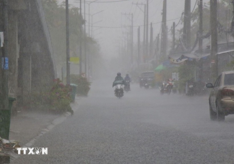
Torrential rains continue to pound Vietnam's Northern and Central regions on August 27. |
Meteorologists warned of further heavy showers and thunderstorms across the northern region and the north-central province of Thanh Hoa through midday. Rain is expected to ease from the afternoon of August 27, but gales may be accompanied by lightning, hail and strong gusts.
Flood levels are rising on the Thao (Lao Cai), Luc Nam (Bac Ninh), Hoang Long (Ninh Binh), Ma (Thanh Hoa) and Ca (Nghe An) rivers. The Thao River was forecast to crest 0.4 meter above Alarm Level 3 before receding. Peaks at 0.3 meter above Alarm Level 3 and 0.2 meter above Level 2 are respectively expected on the Ma and Luc Nam rivers.
Authorities cautioned of flooding in low-lying areas, flash floods on small rivers and streams, and landslides on hillsides in Lao Cai, Phu Tho, Bac Ninh, Ninh Binh, Thanh Hoa, and Nghe An provinces.
In the southern part of the central region, Hue, Da Nang, and Quang Ngai saw 10–60 mm of rain, even over 100 mm in some places, overnight, with flash floods and landslides remaining a serious threat in many areas.
Real-time updates on areas at risks of flash floods and landslides are available on the Vietnam Meteorological and Hydrological Administration’s portal: https://luquetsatlo.nchmf.gov.vn.
At sea, a tropical convergence zone linked to a low-pressure system near the east of the Philippines is fueling southwestern winds at Level 6, gusting up to Level 7–8, and waves of up to 3.5 meters across the East Sea (aka South China Sea). Vessels are warned of rough seas, waterspouts, and high waves.
Source: VNA