In the northern province of Bac Ninh, water levels on the Thuong and Cau rivers have exceeded historic highs. At 5 am on October 9, the water level on the Thuong River at Cau Son reached 18.37m, 0.76m above the previous record, while the water level at Phu Lang Thuong station recorded 7.6m.
    |
 |
|
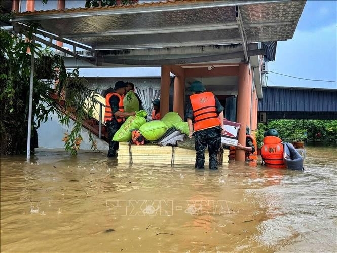
Floods in Bac Ninh province |
On the Cau River, the water levels at Phuc Loc Phuong station reached 9.62m, surpassing the historic peak by 0.22m, and at Dap Cau station measured 7.24m. The water levels are forecast to crest around midday and afternoon on October 9 before receding slowly.
The provincial Department of Agriculture and Environment reported three fatalities in Bac Ninh, over 10,000 households relocated, 1,800 households isolated, one reservoir breached (Ho Coi Gao), 500m of canal damaged, and multiple roads, dykes, and farmland inundated. Authorities have prioritized ensuring safety for people, reinforcing dykes, patrolling flood-prone areas, and delivering food and relief supplies to isolated communities.
Meteorologists warned that heavy rain continues in northern, central, highlands and southern regions, with localized downpours reaching 80mm or more.
Northern mountain provinces such as Lao Cai, Tuyen Quang, Thai Nguyen, Cao Bang, and Bac Ninh remain at a high risk of landslides due to saturated soil and elevated river levels. Landslides threaten communities, block transport routes, and damage homes and infrastructure.
Coastal and sea areas, including the central and southern East Sea, Truong Sa special zone, and the Gulf of Thailand, are experiencing thunderstorms, heavy rain, and strong gusts, with waves exceeding 2m. All vessels operating in these areas are at risk from severe weather.
Source: VNA