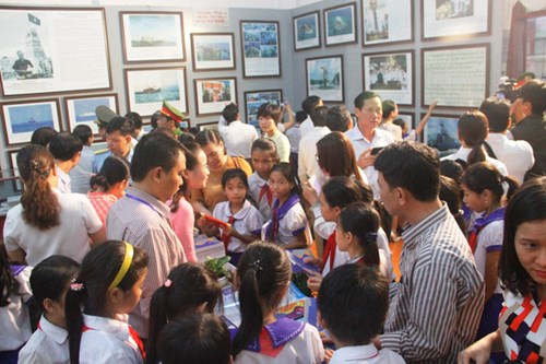
The event, held in Ai Tu of Trieu Phong district, has on display around 120 photos, documents, and maps collected from Vietnam and other countries.
Many of the exhibits were written in the Chinese and Nom (Vietnamese script based on Chinese characters) scripts, some dating as far back as the 16th century.
    |
 |
|
At the exhibition. Photo: dantri.com.vn |
Among them, “Dai Viet su ky tuc bien” (Supplementary Edition of the Annals of the Great Viet), compiled under the direction of Lord Trinh Sam in 1775, records the Lord’s account of sending a small fleet to Hoang Sa archipelago to fish and collect abandoned assets to bring back to the Southern region.
“Dai Nam thuc luc tien bien” (The First Chapter of the Chronicles of Dai Nam), “Dai Nam thuc luc chinh bien” (The Main Chapter of the Chronicles of Dai Nam), and other documents created under the Nguyen Dynasty state that the Nguyen kings deployed forces to Hoang Sa to measure and count the islands, draw maps of them, and plant sovereignty markers, build temples, and plant trees there to help boats avoid being stranded when traveling through the area.
The displayed documents also recorded that the naval force and the Hoang Sa fleet of the Nguyen Dynasty rescued British and French ships stranded in the Hoang Sa archipelago.
Some documents written in the Cham ethnic script also said the Nguyen Dynasty mobilized residents to establish and exercise Vietnam’s sovereignty over the Hoang Sa and Truong Sa archipelagos.
The exhibition also showcases maps drawn by Vietnamese people between the 17th and 20th centuries, as well as Chinese maps of their own territories from the 16th to the 20th century - all of which depict Hainan Island as the southernmost point of Chinese territory.
Meanwhile, maps of Vietnam published by Western countries from the 16th to the 20th centuries also confirm that Hoang Sa and Truong Sa belong to Vietnam.
The exhibition in Quang Tri will last until October 5.
Source: VNA