October 29, 2018 | 21:10 (GMT+7)
Philippines raises warnings, evacuates people ahead of Typhoon Yutu
The Philippines on October 29 raised warning levels for Typhoon Yutu and began evacuating some coastal communities in the path of the storm.
In the morning of October 29, Yutu was about 400km east of the main island of Luzon with sustained wind speeds of 150km per hour, according to the Philippines Atmospheric, Geophysical and Astronomical Services Administration (PAGASA). It is expected to make landfall on the October 30 morning.
Though Typhoon Yutu was less intense after it barreled through the United States’ Northern Mariana islands with wind speeds of over 270km per hour four days ago, it is set to cause havoc to houses, heavy rain and flooding and make landfall.
    |
 |
|
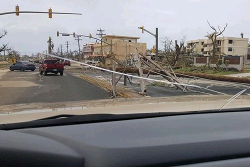
A general view of the damage after Super Typhoon Yutu hit Saipan, Northern Mariana Islands, the U.S. Photo: Reuters |
Authorities in Isabela and Cagayan provinces started moving residents in coastal towns to evacuation centres while the mountainous Cordillera region was put on red alert for landslides.
Three provinces in north Luzon were elevated to warning level 3 on the severity scale of 5, and 28 more put on the earliest warnings of 1 and 2.
The tropical storm will be the 18th to hit the Philippines this year and comes six weeks after Super Typhoon Mangkhut tore across Luzon, triggering landslides that killed dozens of people and damaged about USD 180 million worth of crops.
The US National Aeronautics and Space Administration said that Yutu is likely to be the most intense and powerful storm this year.
Source: VNA