January 16, 2021 | 20:08 (GMT+7)
Vietnam witnesses 10-15 flash floods each year
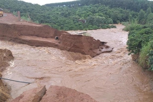
Vietnam records from 10-15 flash floods each year, mostly in the Northern mountainous, Central, Central Highlands and Southeastern regions, Deputy Director of the National Center for Hydro-Meteorological Forecasting Vu Duc Long said on January 15.
He informed that the country is building a project to assess disaster risks in regions and make a flash flood and landslide warning map in the mountainous and midland regions.
    |
 |
|
Vietnam witnesses 10-15 flash floods each year. |
Accordingly, the project will be carried out in 37 mountainous provinces and 34 main river basins and 95 sub-basins.
It will offer flash flood risk maps for 14 Northern mountainous provinces at the 1:100,000 scale and 19 Central and Central Highlands localities at the 1:50,000 scale, while providing data of cross-section measurements in 36 small river basins in the Northern mountainous region and topographic maps at the 1: 5,000 scale for 58 residential areas at risk of flash floods in 19 Central and Central Highlands localities.
Source: VNA