September 16, 2019 | 16:47 (GMT+7)
USAID project assists Thua Thien – Hue in forest management
The US Agency for International Development (USAID)’s Green Annamites Project has recently equipped the central province of Thua Thien-Hue with a forest management system.
As part of the nearly 10 million-USD-project, the system allows automatic connection to the Google Earth Engine (GEE) based-tool developed by the Japan International Cooperation Agency’s Project for Sustainable Natural Resource Management (SNRM).
    |
 |
|
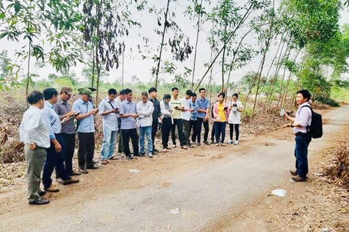
Forest rangers in Thua Thien - Hue are trained to use the forest management system. (Source: baotainguyenmoitruong.vn) |
On a 10-day basis, the system uploads warnings on new deforestation sites on Webgis, which offers free access to information and resources for geographical information systems, while sending the data to forest management agencies and forest owners.
Nguyen Dai Anh Tuan, head of the provincial Forest Ranger Depart, said his department is monitoring the system and a list of administrative units and forest owners to receive frequent updates via SMS and email.
The tackling of any obstacles or technical problems detected during the implementation of the system requires collaboration between the department and the Green Annamites Project, he said.
Thua Thien – Hue is home to 283,000 ha of forest, including 212,000 ha of natural forest. Prolonged drought, fire-fallow cultivation practice, and deforestation are major causes of forest losses.
Source: VNA