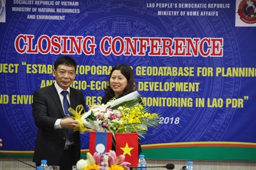
The information was announced at a conference, co-organized by the Vietnamese Ministry of Natural Resources and Environment (MoNRE) and the Lao Ministry of Home Affairs in Hanoi on November 16 to review the project on the work.
The project was part of an agreement on cooperation in economy, culture, education, and science-technology signed by the Vietnamese and Lao governments in 2012.
    |
 |
|
Thong Chanh Manixay, Deputy Minister of Home Affairs, presents a third-class Issara Order to MoNRE Deputy Minister Nguyen Thi Phuong Hoa (R) at the conference. Photo: baotainguyenmoitruong.vn |
Costing nearly VND 184 billion (USD 7.9 million) funded by the Vietnamese Government, the project was implemented from 2014 to 2017. The database and the map having a scale of 1:50,000 feature a total area of more than 170,000 km2 of the Central and Northern regions of Laos.
Phan Duc Hieu, Director of the MoNRE’s Department of Survey, Mapping and Geographic Information, said the project completed all sections on schedule.
He said his department has handed over to the Lao National Geographic Department all associated equipment, software, and a guidebook for the management and exploitation of the database.
Thong Chanh Manixay, Deputy Minister of the Lao Ministry of Home Affairs said the success of the project reflects the friendship between Vietnam and Laos as well as the good coordination between the MoNRE and his ministry.
He said it helped Laos build its own topographic database and train highly competent personnel in charge of running the database in the coming time.
On the occasion, the Lao ministry presented a third-class Issara Order to MoNRE Deputy Minister Nguyen Thi Phuong Hoa. It also awarded the first, second and third class Labor Orders to nine groups as well as other orders, medals, and certificates of merit to more than 50 individuals to honor their contributions to the success of the project.
Source: VNA